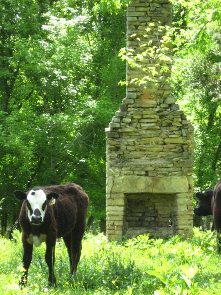
The park decided to leave these on the grounds that they provided a habitat for many species.
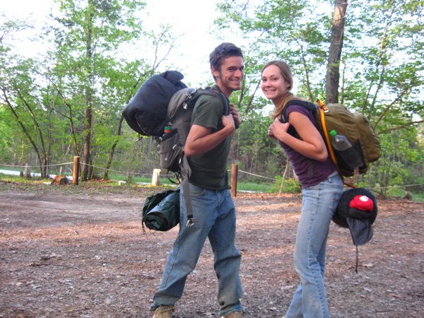
A roadtrip in the American Southeast can prove a planning nightmare. Unlike the southwest or the far north, the southeast has a thousand roads snaking off in every direction. The major attractions hardly ever come in the form of national parks with special map designations, neon signs, publications out the wazoo and 24-hour ranger support, but are more often hidden amongst hundreds of state parks, wilderness areas, wildlife management zones, and random residents' backyards. There is no tourist track, no visitor centers, and, quite frequently, no signs, no established campgrounds, and no potable water. To wage a successful campaign on the southeast, you need a GPS, a car that can negotiate most every road condition, and tons of research and local knowledge. We had my ailing Corolla, a Big Lots road atlas, and a few pages of vague internet directions; we were in for a treat.
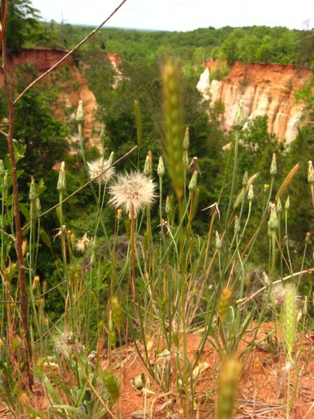
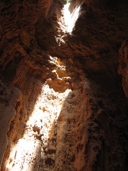
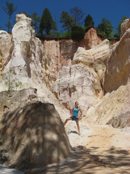
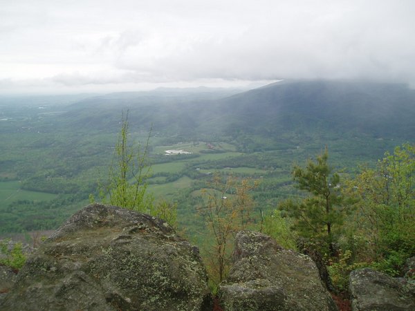
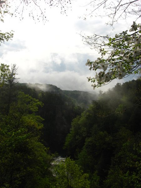
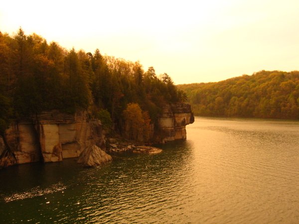
I found Providence on a listing of "The Seven Wonders of Georgia"; advertised as "the mini Grand Canyon", Providence was formed through erosion caused by unsound farming practices some 50-100 years ago. Just three hours north of the Florida border, the canyon is reminiscent of something you would find in Utah or New Mexico, with towering spires of multi-colored rock and sand looming over atmospheric valleys and slots. The ranger seemed reluctant to tell us anything about the hiking trails winding through the park, and so we got a permit for the longest one available, the 7-mile backcountry trail. After we had ventured about 200ft down the trail, we got hopelessly lost in a dense forest, and returned to the well-marked 3-miler. Most of the trail wound through forest with no views, but as we returned to the portion that ran along the road and reached the car-accessible viewpoints, an immense, multi-branched canyon unfolded below us. The real treasure was in the canyon floor trails that followed streams into narrow slots between towering multi-hued walls.
Andie took over driving for the next leg to the north, but as we neared Columbus along the crowded, walled I-185, she began to have flashbacks of the time when we had been attacked by a ladder truck in Atlanta, and pulled off at the next exit. Here we found a Burger King more exquisite than I ever could have imagined such an establishment to be. It was built in the style of an old train station, complete with timetable, ticket window, and dining car. Andie was able to satisfy her cheeseburger craving that she had developed after nearly seven hours of having to subsist in the wilderness with only granola and peanut butter sandwiches, and we got back on the highway, bound for the far northern reaches of the state.
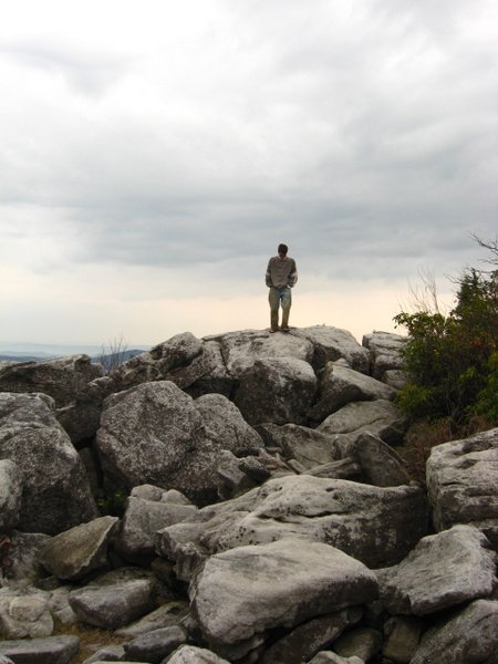
Fort Mountain is an exceedingly pleasant state park on top of a mountain just outside the metropolis of Chatsworth. The only campsites left were walk-in shelters about a quarter-mile from the parking lot. These shelters were perched on the edge of a ravine over a babbling brook, and, in stark contrast to the packed campground, were far apart and largely vacant. For some reason, we deemed it necessary to set up our tent inside the shelter; it barely fit within the roofed platform, and we had to perform harrowing acrobatics over a steep drop-off every time we wanted to use the bathroom or leave the site.
The park decided to leave these on the grounds that they provided a habitat for many species.
Practically the only time she was in the driver's seat the whole trip
This, and all the other artistic shots in the collection, are Andie's doing (you can see a more complete collection of her artsy shots here).
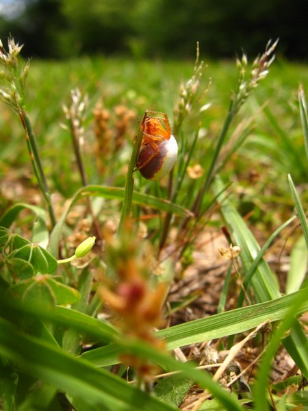
Crazy-looking spider
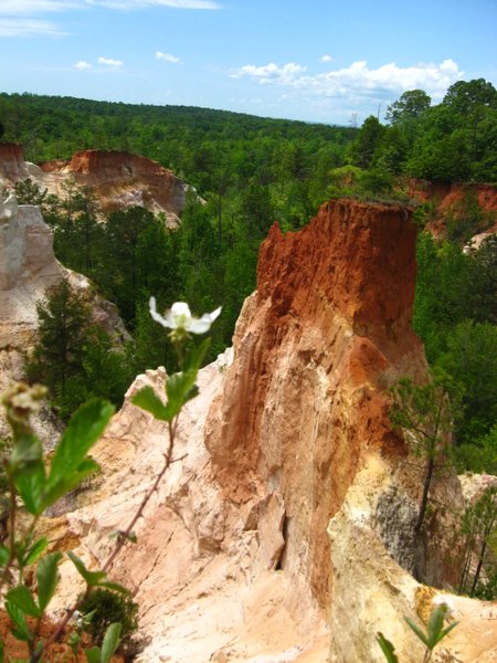
American southwest? Nope, southern Georgia.
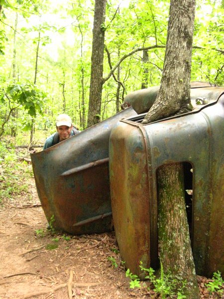
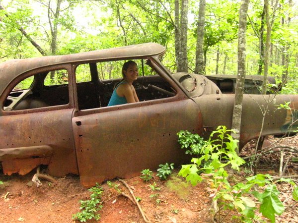
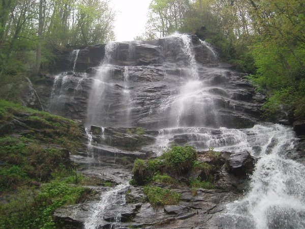
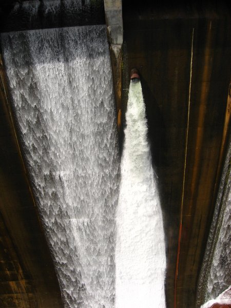
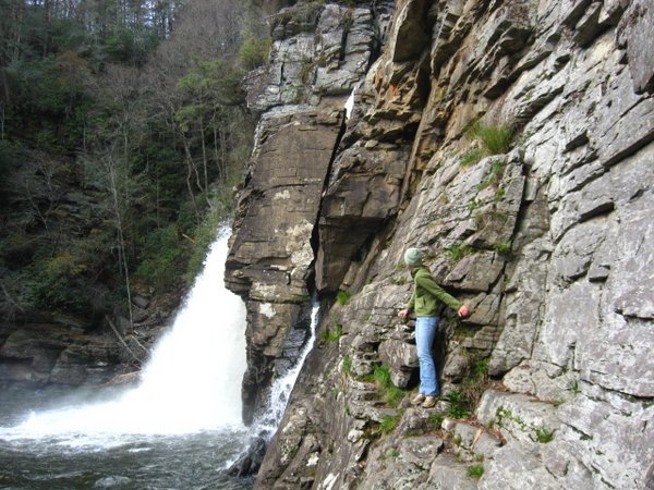
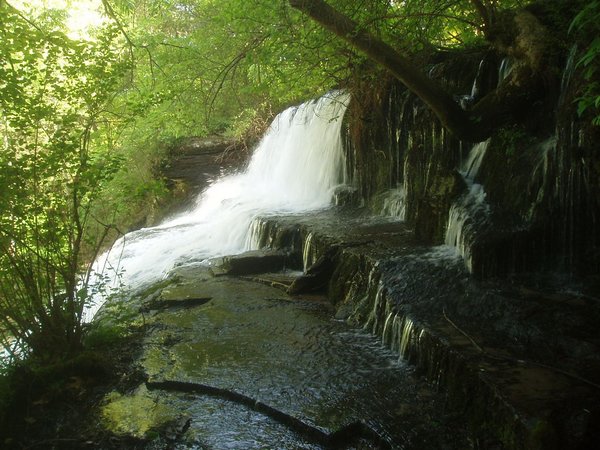
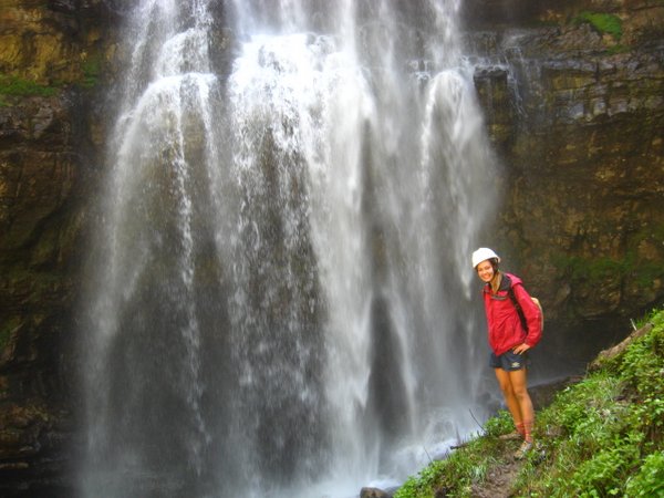
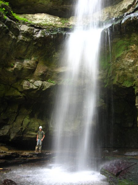
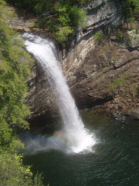
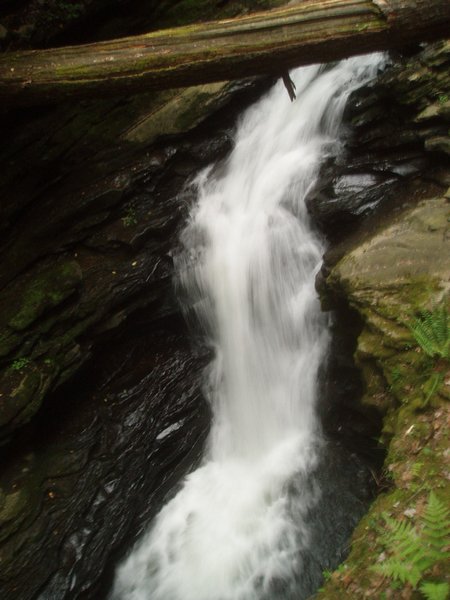
Amicalola Falls was the next stop on the "Wonders of Georgia" tour and there we climbed several hundred stairs to the top of the falls. The cascading waters were indeed impressive, but what really piqued my interest was the decaying car resting on its nose near the base of the falls; no explanation was provided. I tried to convince Andie to hike the 11-mile roundtrip to the Hike Inn (a lodge only accessible by foot) and back along the Appalachian Approach trail, but she seemed a tad reluctant. We instead continued east to Tallulah Gorge to bring our tally of wonders to 3.
View from the top of Fort Mountain
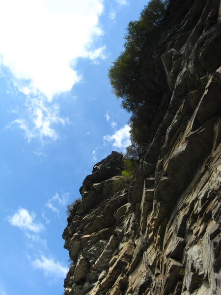
Another of the seven wonders of Georgia
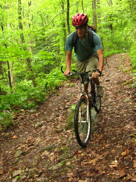
This picture might lead you to believe we actually rode our bikes at some point. We did not.
The next stop was the Tsali mountain bike trails, a set of nearly 60 miles of single-track winding around the extremities of oddly-shaped peninsulas jutting into Fontana Lake. On the weekends, bikers drive up to a thousand miles to try these trails, and they are often packed beyond a comfortable capacity, but when we arrived there was next to no one. Still skeptical about these highland trails from our earlier experience, we chose the easy 14-mile ride. The trails had been thoroughly soaked by the rains of the previous two days, and mud and deep puddles mixed with roots, rocks, and horse poop to provide an obstacle-rich environment. The trail was highly scenic throughout, though challenging or sketchy in parts; one overlook offshoot led us down a stretch of trail that was no more than 6 inches wide with a rock wall on one side and a sheer drop into the crystal blue waters on the other.
We drove onward to Linville Gorge. Knowing nothing about the area, we arrived at several dead-ends before getting on the Blue Ridge Parkway and pulling off at an NPS-operated campground on the banks of the river. There was only one other party in the 70-site campground, a rather eccentric couple who referred to themselves as "the Raccoons", so we had our pick of sites. Somehow we still ended up with a tentpad covered in goose turds.
Wonder #3
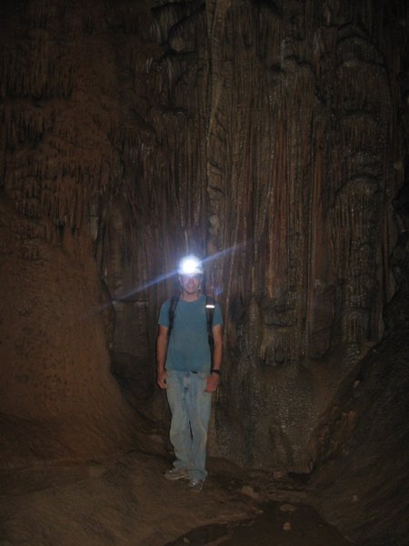
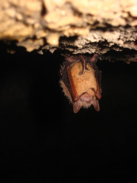
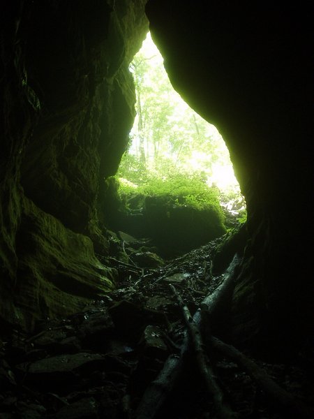
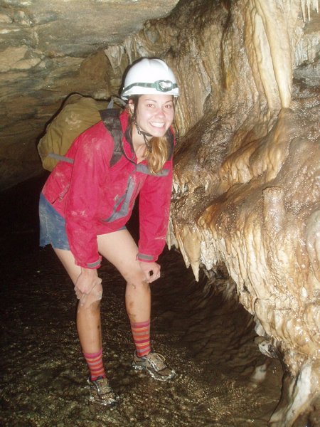
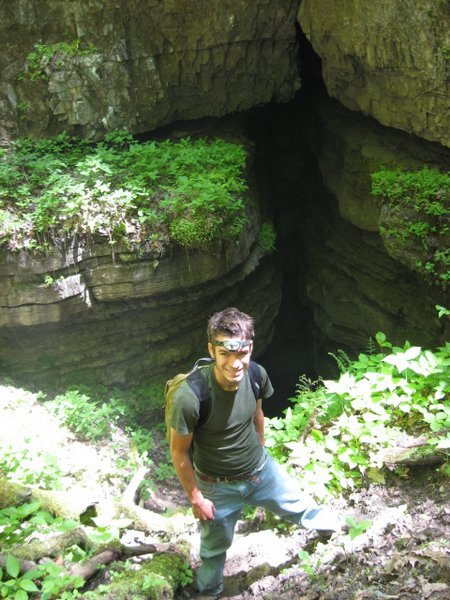
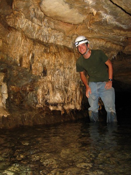
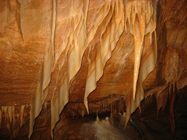
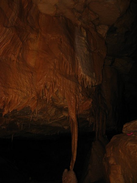
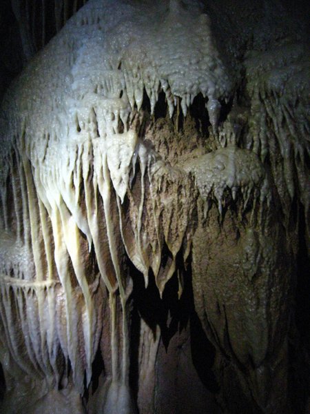
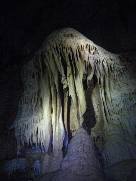
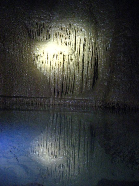
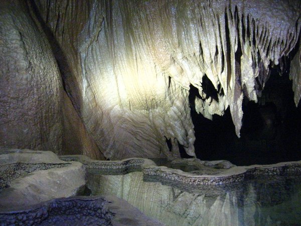
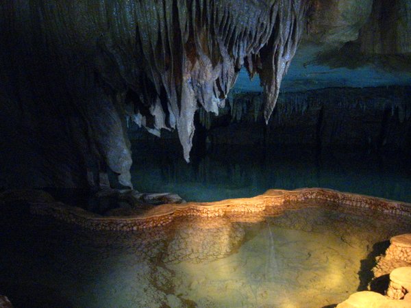
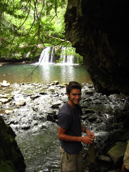
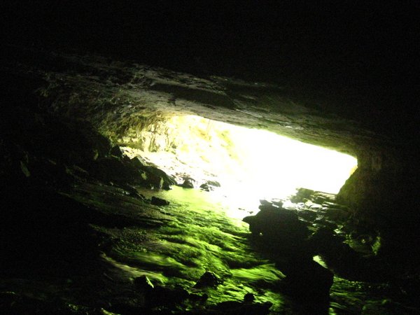
Whorley's Cave is a mile down a residential street in a tiny town in the far northeastern corner of Tennessee. We deposited $10 in the owner's mailbox to cover our admission fees and prepared to go searching through the brush, but he showed up just in time to give us a map and explain how to find the cave. It was not hard to find the mighty river that flowed out of the cliffside, and right next to this lay two massive, blowing entrances. The gate on the main entrance was well-aged, and after pushing and pulling for some time with no luck, we conjectured that it might be rusted shut; it eventually opened, though, and we closed it behind us, hoping that it could be convinced to open again in a few hours' time. Nearly the entire cave was huge walking passage, and there was little in the way of climbing or crawling. Despite its high frequency of use, many of the cave's giant formations were relatively undamaged, which made it a worthwhile, though somewhat easy, trip. We eventually got lost and returned to the entrance within 3 hours of our start.
We took I-81 up through the Shenandoah Valley of western Virginia. This stretch of road must have the highest density of trucks anywhere, and I felt utterly insignificant while dodging through the endless stream of behemoths. The frequent elevation changes insure that you can never separate yourself for long, for those trailers that slowly chugged up one side of a mountain, will shortly be barreling down the other. We slept at a rest area and arrived in Paw Paw, WV around 9am the next morning.
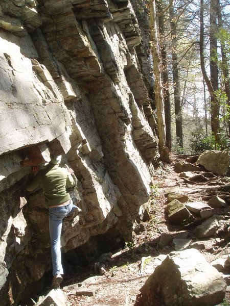
Andie showing off her moves at one of the south's premier climbing destinations
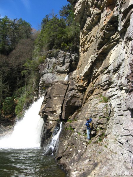
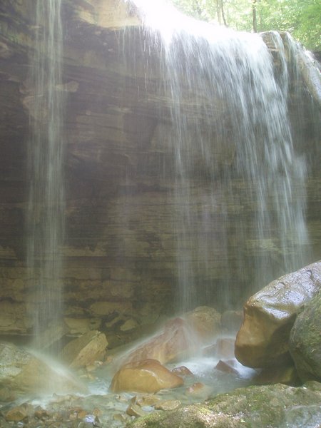
Up close and personal with the lower falls
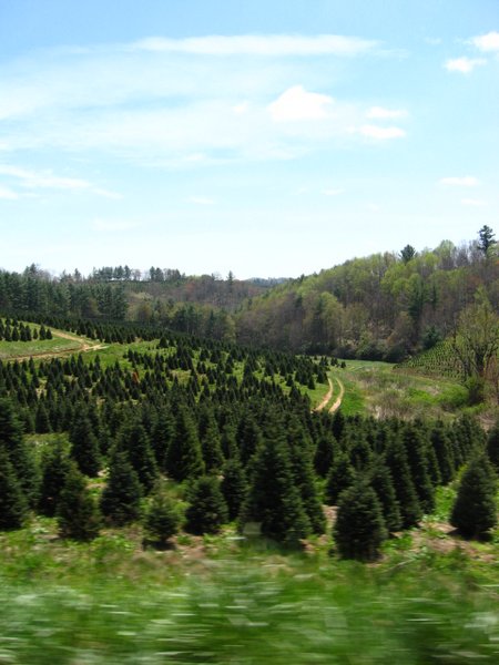
Christmas tree farm
Whorley's Cave
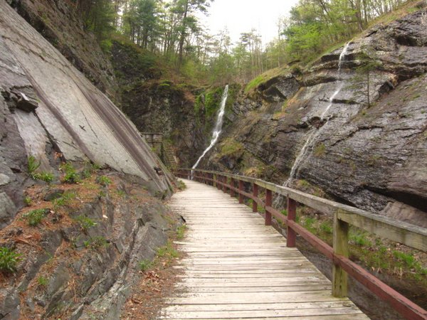
We drove over to Cumberland, MD which turned out to be a very pleasant city, packed to the brim with history. From there, we drove south to Seneca Rocks. In the last moments of daylight, we saw an NPS sign for camping and followed a winding road for 30 minutes before deciding it wasn't going much of anywhere and returning the way we had come. We continued down the highway until we reached another government campground just before it closed for the night.
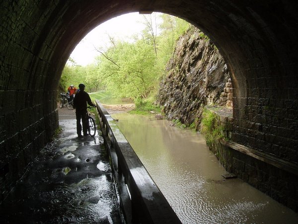
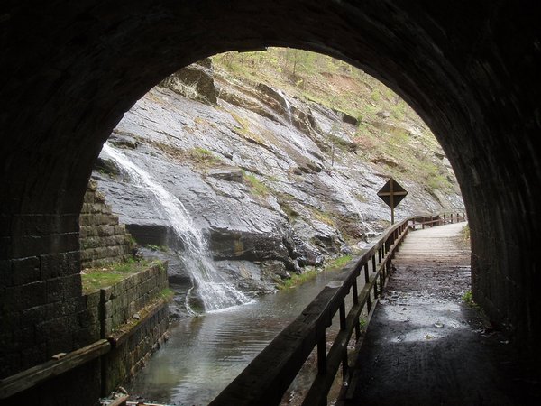
The Paw Paw Tunnel
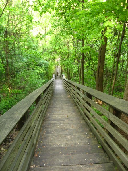
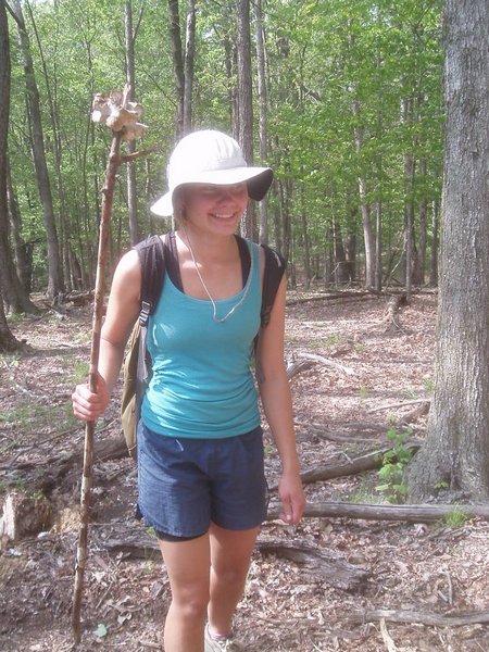
Andie enjoying the trail's fine facilities
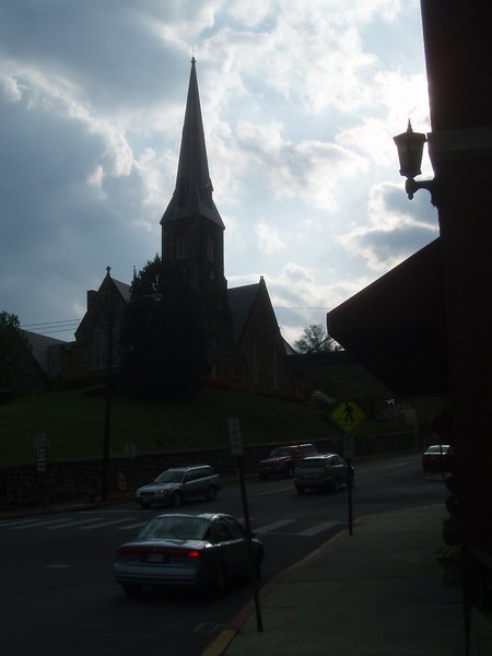
Cumberland, MD
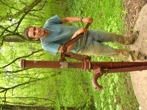
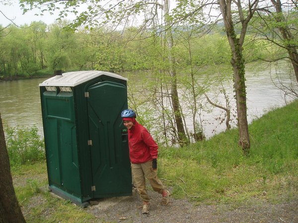
These things actually work! And if the world happens to be sideways at the time of use, you hardly have to pump at all!
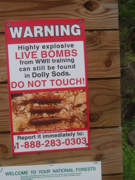
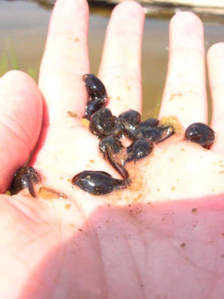
The managers of Dolly Sods are unusually intent on maintaining the natural state of the land, and have therefore spurned such artificial improvements as paved roads, trail markers, or World War II ordinance removal. Signs throughout the area proclaim that it is not for inexperienced hikers and that all should carry a compass and adequate supplies before venturing into the wilderness. From one of the map boards, we decided on a loop comprised of two trails; there was no scale or trail description, so we had no clue how long such a loop would take. It turned out to be an exceptionally long time, and we ended up following the GPS and bushwhacking out to the road to get back before our supplies ran out. The first part of the trail was a depressing mix of dead trees and "sods", which were grassy areas used by the settlers some time back. The second part was a vibrant forest, reminiscent of the rainforests of the Caribbean. In one of the streams we found a number of frog egg sacks and Andie spent a long interval on a photo shoot of the tiny developing tadpoles.
We decided to forego any further hiking and instead headed south towards Summersville. Along the way, we caught a glimpse of a restaurant sign that read "wild game burgers" and we came to a screeching halt. Much to our dismay, the game on offer was not squirrel or bear from the backwoods of West Virginia, but instead bison from the rocky mountains. We ordered a cheeseburger and vegetable plate, but could hardly enjoy them given our disappointment that we were not feasting on boar goulash or skunk souffl�.
We arrived at the Gauley River National Recreation Area in time to pitch a tent a mere two feet from the banks of Summersville Lake. The geese glared at our tent menacingly but held off on an assault.
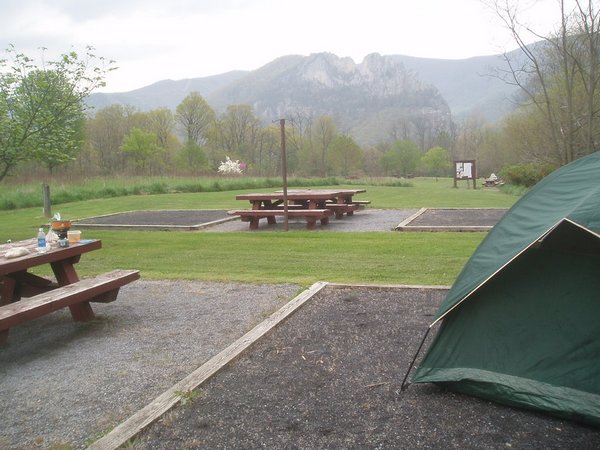
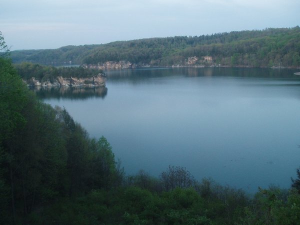
A very scenic and empty campground
It is fortunate indeed that we did not happen upon any of these, for Andie would surely have added them to the collection of "treasures" that she accumulated in my trunk over the course of the trip.
A cold, blustery morning at Dolly Sods
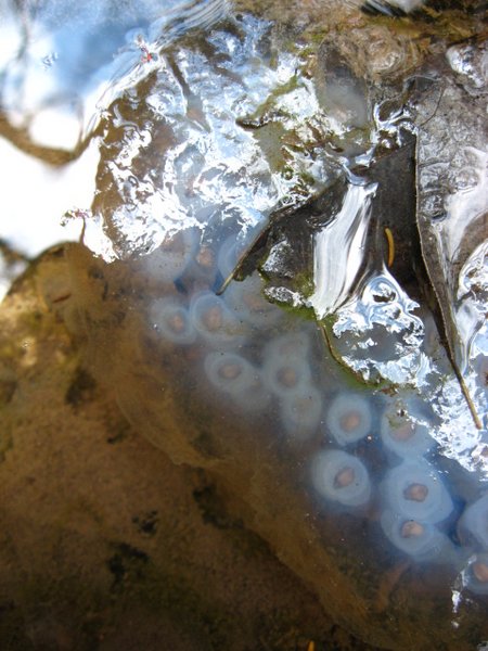
Frog egg sack
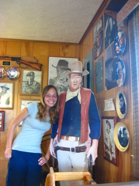
Andie and John Wayne
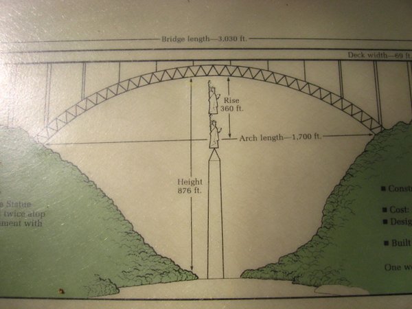
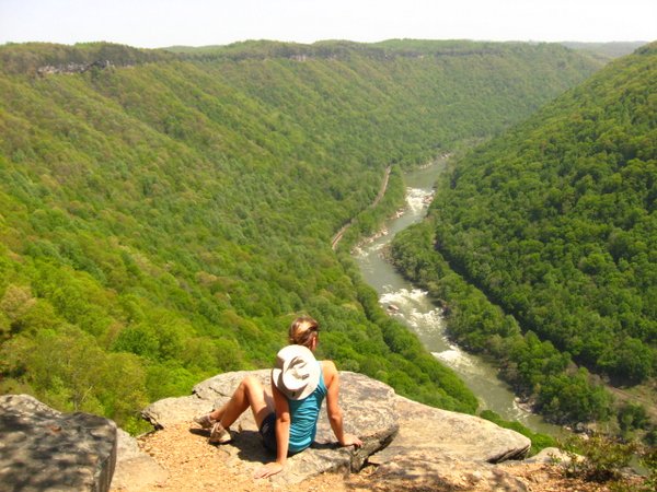
The New River Gorge, just down the road from the Gauley, is the site of a bustling national park, a number of ghost towns, some of the best climbing west of the Mississippi, and the second-highest suspension bridge in the country. One day each year, hundreds of thousands of people gather to bungee jump, rappel, and base jump off the 876' bridge; sadly, we had not arrived on that day. We took the Diamond Point trail to get to a stunning gorge overlook and scrambled along the seemingly endless "Endless Wall" which was covered in chalk and hardware from the climbers who supposedly frequented the place (we saw zero). We next took 1200 steps down to Kaymour Bottom which featured an extensive abandoned mine site and the ruins of an early 20th century coal mining town.
We followed the exceedingly scenic highway 60 west towards the Kentucky border. The towns that punctuated the road looked for all the world like New England fishing villages that had been picked up and moved to the mountains. As we drove along the interstate, we noticed that every exit had a fast food restaurant we had never before encountered; the constant signs for Tudor's Biscuit World taunted us, as we were quite sure that this seemingly prolific establishment would cease to exist the moment we reached the border. We got off at the next exit and hunted it down, but found, to our profound disappointment, that it was not open for dinner. Our craving for biscuits would thus go unsatisfied.
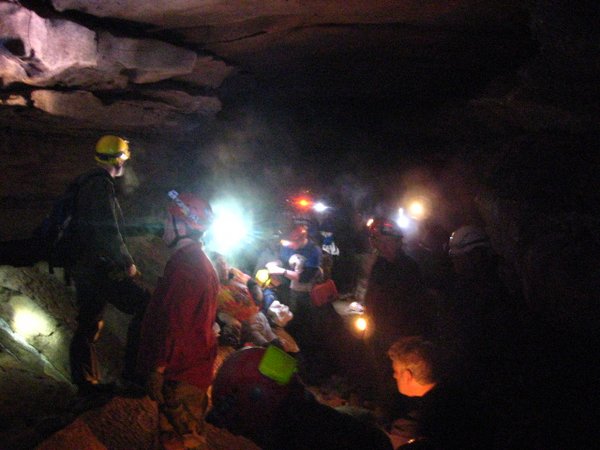
When the government took over Mammoth Cave, an agreement was made that the three ferries that carried cars across the park's small, highly bridgeable rivers would never be removed. Thus, it was impossible to get from the park's main entrance to the research station where we were staying for the weekend restoration field camp, outside of the ferry's operating hours. It was therefore necessary that we locate the park's unmarked north entrance. After a few hours of driving down poorly signed farm roads, we arrived at the camp at 1AM.
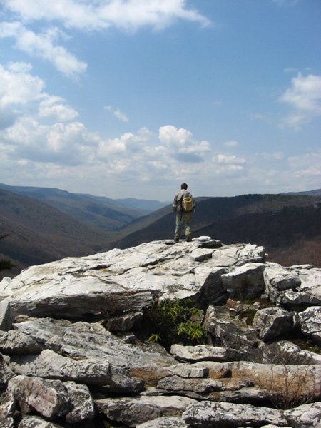
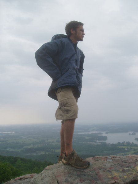
Atop the epic cliffs of Summersville.
Exploring the climbers' access at New River Gorge
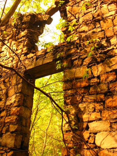
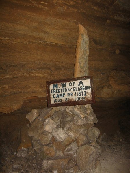
In remarkably good condition after some 90-odd years
Most random comparison ever.
The ruins of Kaymoor.
Just a quick 1200 steps to the bottom
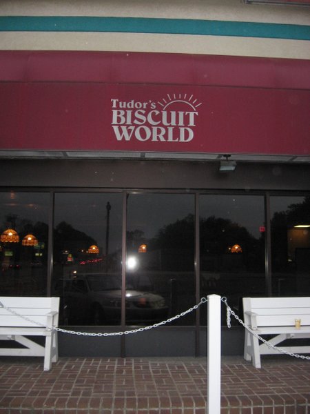
You win this time Biscuit World...
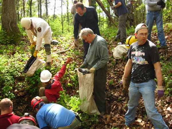
Somehow our 47-strong cleanup crew was let right in...
After a grueling 30 minutes of cleanup - lunchtime!
He probably thinks you're upside down too
The remaining holes yielded no serious leads. The first one went about 8 feet and abruptly ended and the second dropped into a pit which no one had a rope to rig. The third had an extremely narrow entrance and the first to attempt its exploration got stuck halfway. As one of the smallest cavers on hand, I was elected as the one to complete the survey. I barely fit through the first crevasse and reached an even narrower one within a dozen feet. With a handline and some awkward contortions, we were eventually able to extract me from the cave.
As an added bonus, the camp had arranged a free tour of Diamond Caverns for all the participants. This was a typical show cave with lights, railings, sidewalks, and an annoying teenage guide, but it was rife with interesting historical tidbits. The cave had been discovered in the mid 19th century when the land owner had lowered a slave boy down a small hole with a candle; a larger hole was later dynamited to provide easier access. In the 60s, the cave was one site of a vicious series of "cave wars", where employees of the neighboring commercial caves in the area would break into the caverns and break off many of the formations to diminish the tour's appeal. Until the 90s, the cave was also the site of regular weddings, and an elaborate altar made of formation pieces is still implanted in one of the back chambers. Behind the main show cave is a small mud pit known as backyard cave; we were granted access to this but stopped after a dozen feet because we each only had about one pair of pants.
We drove south to Sparta, Tennessee and sought out Virgin Falls Pocket Wilderness. There was no camping at the trailhead or anywhere nearby, so we lashed our sleeping bags and tent to our daypacks and hiked the two miles into the first campsite. This was a near-perfect spot next to a swiftly-flowing creek with a number of small waterfalls - we would soon find out that this was by far the least appealing of the trail's options.
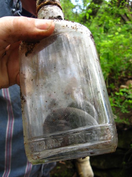
Snake in a bottle
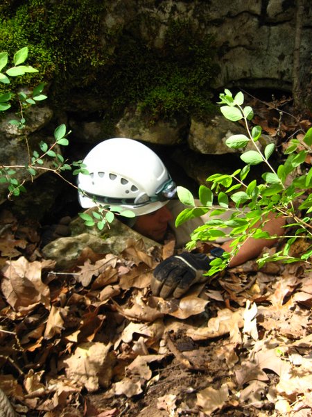
Absurdly narrow entrance into an unknown cave? Send the new guy!
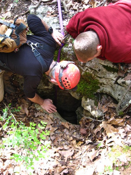
Fishing me out
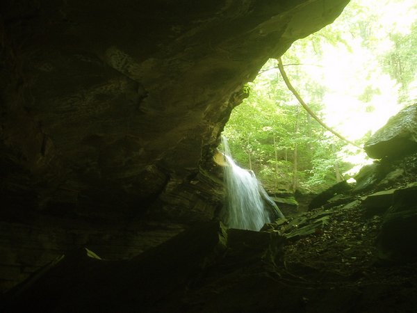
Further down the trail was an epic cave mouth at the bottom of a treacherous slope. Lacking a handline (which would certainly be desirable), I used a piece of string someone had secured to a tree to descend into the cave. At the mouth, a mighty waterfall descended from a channel in the rock and disappeared into the ground. Climbing to another cave entrance at the same level as the trail, we found that a waterfall there actually feeds into this upper entrance, flows through several chambers, and exits via the lower entrance. Sheep Cave is a long stream passage above the upper entrance which most likely feeds into the upper waterfall. Just to review - this is a waterfall that flows out of a cave, drops over 50 feet to a second cave, flows through this cave, and finally drops 20 feet into a third cave - I can't say for sure, but this might just be the single greatest thing ever.
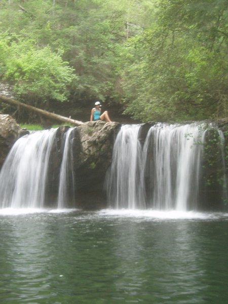
The namesake attraction of the trail is an enormous waterfall that flows out of a navigable cave, descends 100+ feet, and instantly disappears into another cave. Campers have the option of setting up their tents at one of three overlooks or right over the source of the falls. We set off to explore the cave at the top of the falls but soon found it to be full of unusual-looking spiders which Andie identified as black widows, and promptly left after only a hundred feet of passage; upon closer consideration, I was fairly confident they weren't black widows, but once someone yells "deadly spider", the joy of exploration is difficult to recover.
We finished the trail and returned to Sparta where we tapped the library's wifi to figure out where we were sleeping that evening. We had made arrangements with one of the Tennessee people at the camp to sleep at the grotto campsite but had thus far received no directions. Quite unexpectedly, an email turned up that explained that our friend Tyson was currently driving up from Gainesville and would arrive in Sparta within the hour. We arranged to meet him and found GPS coordinates for our campsite.
The road to the site, which turned out to be along a stream in a farmer's backyard, was covered in large rocks and was definitely not intended for a compact car. Luckily, both my Corolla and Tyson's Civic made it in without sustaining any serious damage and we set up camp alongside a cow pasture and semi-abandoned barn. Tyson claimed to be too lazy to set up his tent and went to sleep in his car, while Andie and I grabbed a spot next to the creek. We were just settling off to sleep when at around 10PM, a cacophony of other-worldly sounds, like none we had ever heard, erupted over the pasture. A chorus of howls, of a forlorn sort that chilled us to the bone, accompanied by a bizarre yipping noise, echoed through the night sky. Andie made a mad dash for the car, and, intent not to face these demon beasts alone, I was quick to follow. It was explained to us the following day that these sounds came from a pack of coyotes that scoured the fields each night for dead cows or unguarded calves; this did reasonably little to quell our fears and we would spend the next night in our car as well, if only to avoid hearing those dreaded howls again.
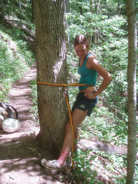
Guys have always had the upper hand when it comes to peeing off narrow ledges, but Andie quickly engineered a solution for members of the fairer sex...
Big Laurel Falls
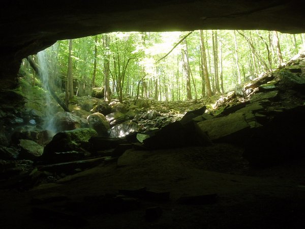
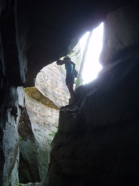
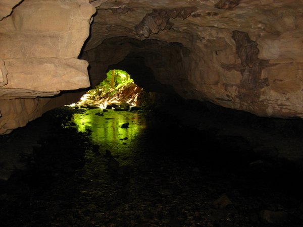
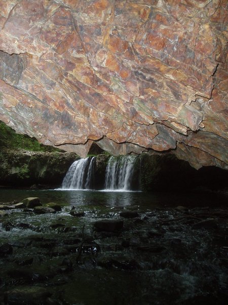
The cave between two waterfalls
Check out those socks!
Top of Virgin Falls
No backpacks? Improvise!
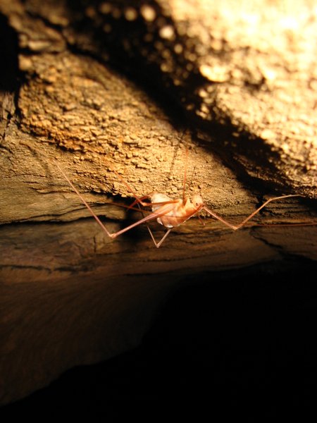
Cave cricket
Sheep Cave
Virgin Falls Overlook
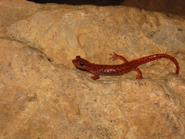
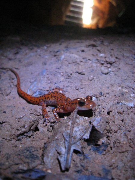
Cave Salamander
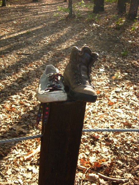
Abandoned footwear
Anne's friends took us down the road to Lost Creek Cave; this was far more frequently visited than Blue Springs, but did have a huge entrance, a large waterfall, and an array of interesting "cave art". We were told that this cave was used in the filming of the movie "The Jungle Book" (not the cartoon, the other one).
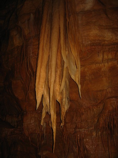
Delicious cave bacon
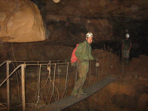
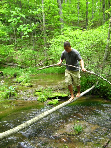
Bridge constructed over 50-foot chasm using only old tractor parts.
Our campsite neighbors
Tyson showing off his skills
I was leading the way up a perfectly ordinary stretch of level dirt trail, not really paying much attention to my footing, when I was abruptly transported to a classic B-movie scene. A massive scaly form slithered within inches of my feet, and in the next instant, I had leapt backward, and the eastern rattlesnake, with a body as thick as my warm, had wound itself into a tight coil and poised its head to strike. I took a moment to recover my wits and then frantically dashed back the way I had come. We discussed our options as the rattler remained in the same position, fervently rattling its tail. We concluded that it would probably be best just to wait it out, but after 5 minutes it still sat there; occasionally it would get tired of rattling and stop, but after a few seconds break, it would putter to a start again, never dropping its menacing stare. Tyson decided it would be a good idea to poke it with a stick, so he retrieved a particularly long one and prodded the snake until it moved a safe distance from the trail. We then passed and continued our hike, a little more wary than before of where we stepped.
The remainder of the hike had us scrambling over boulders and offered many interesting rock formations, waterfalls, caves, and swimming holes. We had somehow taken far longer than we anticipated and had to race through the last few miles in order to finish by dark (since night hikes were expressly forbidden).
We returned to our car and prepared dinner at the parking lot so we would not have to carry our food or stove the half mile to the campground. Halfway through our meal, a ranger showed up and closed the gates and locked the bathrooms; he seemed strangely oblivious to our presence some 20 yards away, and our obvious need to hike after dark to our campsite.
Foster Falls
Andie the savage and her vertebrate-tipped snake stick
Swimming hole
Black canyon
Andie's new pets
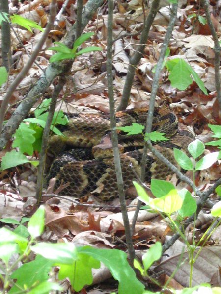
Biggest snake ever
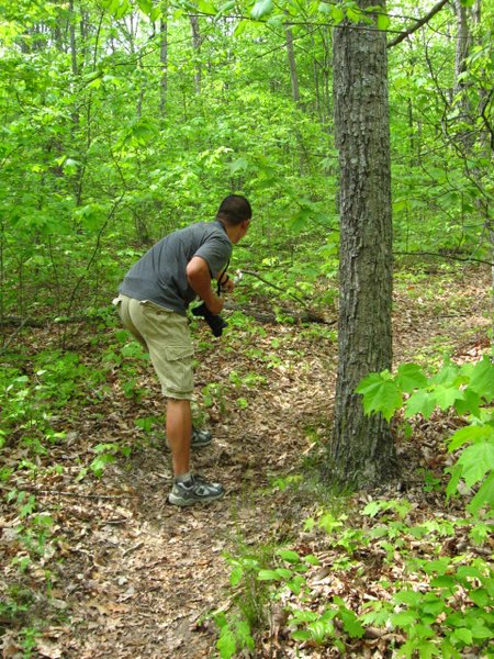
"I know", said Tyson, "Why don't we poke it with a stick!"
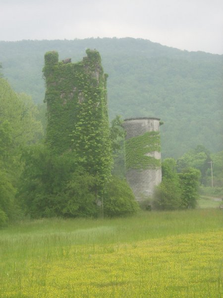
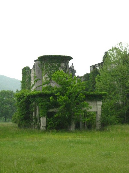
We headed south into Alabama to reach the first of a few climbing areas we had planned to visit. Along the way, in the town of Sherwood, the ruins of something that looked vaguely like a castle beckoned us to explore them. Unfortunately, there were "No Trespassing" signs everywhere and Tyson was in the process of getting a government job, so we had to be satisfied with a quick photo shoot from the highway.
The climbing area at Sand Rock is not an easy place to find, and we circled the town a few times before happening upon the right road up to Cherokee Rock City. Renowned for its scores of giant, climbable boulders, Sand Rock offers a plethora of routes with an amazing view of the lowlands. Sadly, we were there the same time as a nasty front, complete with a high chance of tornadoes, and after a few attempts at scaling the soggy rocks in between showers, we aborted our camping plans, fled to the interstate and sped back to Tallahassee.
Buggytop Cave
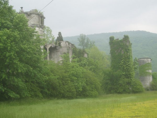
Ruined castle?
View from Sand Rock boulders